 Polski
 Deutsch
distance (km)
altitude m a.s.l.
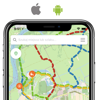
Walking,
green
22,8 km
6h 15min
(6h in opposite direction)
↗
164 m
↘
96 m
 Prochowice
  Legnickie Pole, muzeum